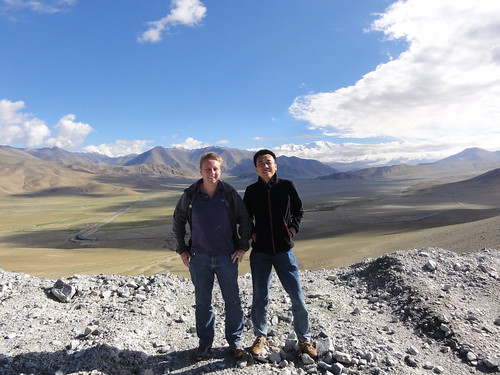
Gary and me on a 4200 meter Karakoram Highway pass
The part of the Silk Route from Kashgar in China to Islamabad in Pakistan is called the Karakoram Highway (KKH). We had heard that it’s one of the most beautiful roads in the world, so we decided to get a car with driver and a guide and see this road for ourselves.
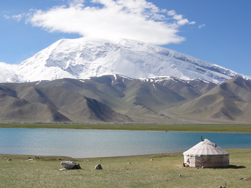
Lake Karkul, along the Karakoram Highway
Because we both did not have visa for Pakistan and you can’t get visa on the border anymore (in the past that was possible), we decided to go to Tashgurkan (sometimes also spelled as Tashgorkhan or Tashgorkan), the last village before the Pakistan border. We left Kashgar around 9:30 in the morning, which is very early considering that the real time is actually 3 hours earlier: Beijing time is used in the whole of China, but when you are several thousand kilometers to the west of Beijing you can imagine that nobody follows the official time anymore.
I thought we would drive out of the city right away, but it turned out that we first needed to get a permit from the military to drive the KKH. It was quite busy and very warm inside the military office and people tried to sneak past you in line. After waiting for almost an hour we managed to get the permits – or actually just one permit: it turned out that only Chinese need a permit, but foreigners don’t.
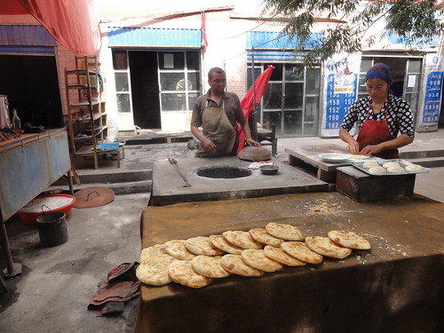
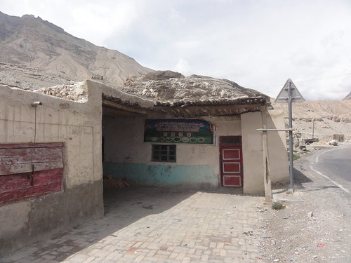
Baking and selling naan bread next to the road
After that it was a smooth ride for the first part of the KKH. We stopped after about an hour at a village to buy some naan (bread) and some fruit. The muslim sellers could not eat themselves during daytime because of Ramadan, but they luckily had no problem selling food to tourists. Also our guide and driver both ate something, despite both of them being muslim. They explained that you don’t have to fast if you travel during Ramadan, but that you need to catch up at a later time. I was glad that at least the driver ate and drank, the KKH is not a road where you want to get into an accident!
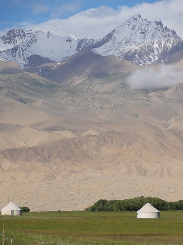
Yurts on the grassland next to 7000+ snowcovered mountains
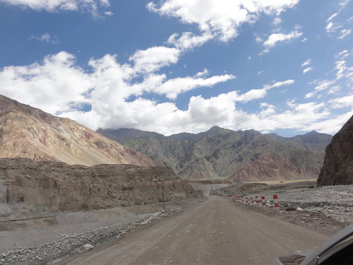
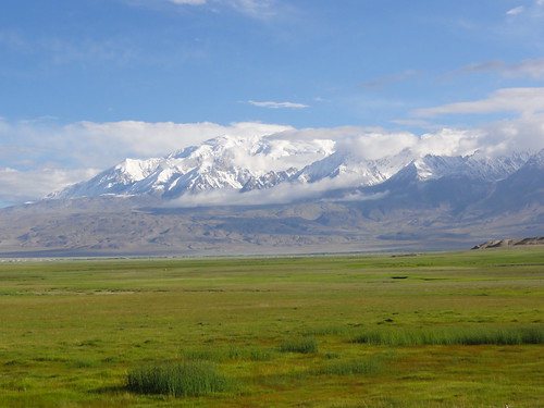
After the village the mountains started and the scenery was stunning. Snow covered mountains (many over 7000 meters) surrounded us, we saw fast flowing rivers, waterfalls, huge grasslands and beautiful lakes. We soon were over 3000 meters, meaning that nothing grows anymore except some grass. Our guide told us that some of the people living here never eat vegetables, I wonder how that’s possible.
Most of the Karakoram Highway in China is in pretty good condition, this is one of the few unpaved stretches
The road was generally quite good, except for some places where the road had been washed away by rivers of melt water and for a few landslides. These landslides happen regularly and you just have to hope that they don’t occur when you are driving there. At the first landslide that we passed (and that had been mostly cleared away) the driver told us that a car had been caught below the falling rocks and mountain of sand. That did not give me a very safe feeling, but of course this is anyway not the safest place on earth.
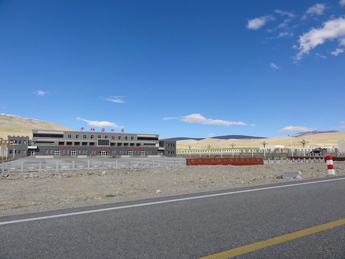
Fastfood restaurant next to the police check point on the Karakoram Highway
We saw a few more accidents, for example a truck coming down the mountain from Pakistan that braked too late (or which brakes failed?) whose driver was very lucky to survive. His truck slipped off the road in a curve at 4000 meter altitude, but only the cabin hung over the edge. The rest of the truck somehow got stuck in the sand, so it did not slip over the edge.
When we got a bit higher into the mountains we came to a roadblock, where the police checked our IDs. My passport was scrutinized for a few minutes but eventually they let me through. The guide told me not to take any pictures of the police check point, so I did not do so. That’s the sort of thing that can get you into real trouble here.
Checkpoint to the Tajikistan border
Along the road we saw different minorities, and the guide helped us to identify them by their hats. I had not noticed it, but Tajiks wear indeed very different hats from Kazakhs or other ethnic groups. The area where the KKH runs is very close to several countries: We passed by the customs/immigrations building for Tajikistan (we were not allowed to drive to Tajikistan), Afghanistan was less than 50 km away from our hotel (the border has been closed, so no chance to go there either), and of course the KKH crosses into Pakistan.
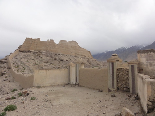
Stone City in Tashgorkan
Around 5 PM we arrived in Tashgurkan where we had reserved the best hotel in town (Crown Inn). It was indeed clean and it had decent Internet, which is enough for me. We made a walk around town before dinner, which was fun but also a bit tiring because the town is at about 3600 meters altitude. We climbed up to the Stone City (a fort) from the backside, from where we had a great 360 degree view over the valley to all the mountain passes around us.
Grasslands close to Tashgorkan
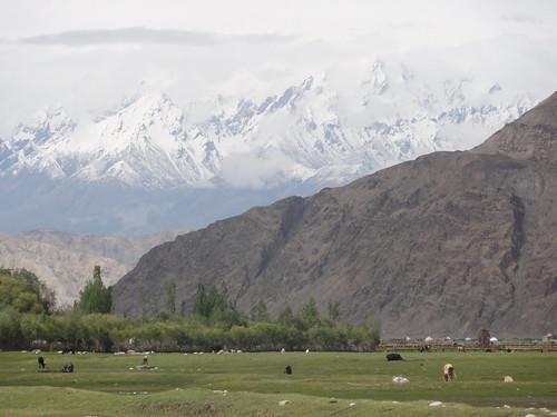
Tashgurkan was an important stop on the Silk Route because of the grass wetlands surrounding the village. In the old days the camel and horse caravans would stop here to give the animals and people some rest. Nowadays the trucks stop here as well and the grasslands are still used by the nomads who put their yurts and animals there in summer. We had a coke in a very old and dirty bar (the only one in town it seemed), with next to us a group of Tajiks who were getting quite drunk at 6 pm already (which is actually 3 pm Pakistan time!). Well, I guess there is not much else to do here anyway.
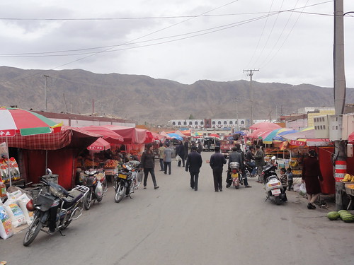
Tashgorkan bazaar
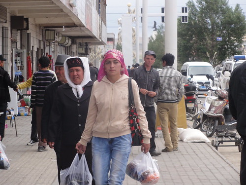
After a walk in the bazaar we headed back to the hotel. Walking through town I realized that there were a lot of blond people around. Not tourist, but locals. Some of the people could have been European, you would not see the difference. Quite amazing actually. On Twitter someone said that one of Alexander the Great’s armies got lost here and that was why people here are blonde. Not sure whether this was serious or not, but it certainly might help to explain this anomaly.
Main Street, Tashgorkan
In the hotel we ordered dinner, which takes about an hour to cook at this altitude. So we relaxed a bit in our rooms and I managed to call my parents via a Skype video call on my phone. The connection wasn’t great, but it was nice that it worked, especially considering the fact that in this part of Xinjiang people can’t make international phone calls (even on local mobile phones all international calls are blocked according to our guide).
After dinner Gary and I discussed some books over a beer (among others The Monk and The Philosopher) and then we headed to bed. I didn’t sleep well despite the fact that it was completely silent at night. I got up at 7:45 to go for a run when it was still pitch black outside. During the run the sun started to rise over the mountains, a beautiful sight. Running itself did not go very easy, partly because of the high altitude and the cold (I was even wearing a hat), and partly because of the semi wild dogs that roamed the streets. I had to stop a few times to make sure they would go away, and at a certain point I had to run through the wetlands because the dogs were in the middle of the road that I had wanted to run on.
Grasslands next to Tashgorkan village
The run showed me the town from a different perspective: at 8 AM most of Tashgorkan was woken up by loudspeakers broadcasting the news. At the hotel you did not hear these, but at 3 strategic locations there were huge loudspeakers that made sure you would wake up. And indeed, a few minutes later the first people started to come out of their houses, looking at me like I was crazy, running around in shorts at this time of the day.
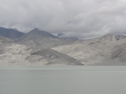
Lake and desert-like mountains on the Karakoram Highway
After a big breakfast we slowly drove back to Kashgar again. We stopped a few times to do a bit of hiking or to take some pictures of the beautiful scenery. Our guide told us that several movies had been filmed here, but only one of them I knew: The Kite Runner. He had actually worked with the production crew, and he showed us some of the locations in Tashgurkan, on the KKH and later in Kashgar itself.
In the afternoon we were back in Kashgar, where we did not want to stay another night, and we decided to take a plane to the far north of Xinjiang (the border of Russia, Mongolia and Kazakhstan). We heard about Lake Kanas (Kanasi) which was supposed to be beautiful as well, so we wanted to check it out of course. It turned out to be a different experience than the KKH, stay tuned for the details in my next post!
This is my second post about the Xinjiang trip with Gary. The first article about our experiences in Kashgar is here. All pictures of this trip can be found here.
Its good you made it all the way down to Taxkorgan, not many people do. The border you see there with Pakistan is actually the entrance to the demilitarized zone, which extends another 120km through the valley until you reach the Pakistan border proper near Gilgit.
As for the ancient Fort you saw there nd have a photo of, Marco Polo stayed there and so did Xuanzang, the Chinese Buddhist Monk who travelled to India and inspired the story “Journey To The West.” Historic silk road lands you’ve been visting there. Incidentally the Chinese border with Afghanistan is also very close to where you were. There’s a lot of Afghani’s there and many of them are blond – a legacy of Alexander the Great also passing through that area. Well done – Chris
Your trip to Tashgurkan is amazing!
i took the bus 23 years ago from Islamabad to Gilgit (not sure how many days it took). i have always wanted to go back, Pakistan and especially the north east is stunningly beautiful. Those days were relatively safe (although the bus did need armed guards); nice blog post, will try to find time some day to try the other side of the Karakorum as it may take quite some time before it makes sense to go back to Pakistan side.
Glad you guys had a great time in Tashkurgan and Karakorum highway. As you mentioned, the checkpoint for the permit is located at Gaz where they check the permit for Chinese citizens,but for foreigners, they check the permit from the travel service, rules at check point change from time to time depending on the political stability of the area and relationship of the surrounding countries.